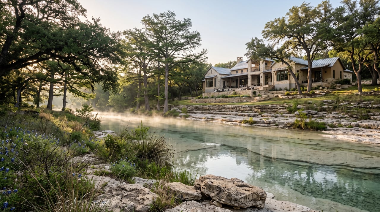
A creek view pulls families toward a Hill Country home. It also raises the first question every careful family should ask: what does the water do when it rains? Boerne sits in the part of Texas known as Flash Flood Alley, and Cibolo Creek, Menger Creek, Frederick Creek, and Curry Creek all carry runoff through town. Reading the risk on a Boerne property takes more than a glance at a flood map. This guide explains how FEMA flood zones and Boerne’s local floodplain work, which drainage details separate a sound lot from a risky one, what Texas sellers must disclose, and how to verify any property before you make an offer.
How Flood Zones Work in Boerne
FEMA Zones and the Flood Insurance Rate Map
FEMA sorts land into zones on its Flood Insurance Rate Map. A Special Flood Hazard Area, shown as Zone A or AE, carries a 1 percent annual chance of flooding and is called the 100-year floodplain. Shaded Zone X marks the 500-year floodplain, a moderate-risk area. In Boerne, mapped Zone AE areas have followed Cibolo, Curry, Frederick, and Menger Creeks. Maps get revised, so the effective map for an address matters more than a map from an older listing.
What does it mean to be in a 100-year floodplain?
A 100-year floodplain is land with a 1 percent chance of flooding in any given year. Over a 30-year mortgage, that adds up to roughly a 26 percent chance of at least one flood. FEMA maps these areas as Special Flood Hazard Areas, and lenders require flood insurance on federally backed mortgages for homes inside them.
Boerne’s Local Floodplain
The City of Boerne regulates a local floodplain in addition to the FEMA floodplain. Boerne adopted floodplain ordinances in February 2020 and added them to its Unified Development Code in July 2021. Boerne requires a floodplain development permit for any development in the FEMA floodplain or the local floodplain. New construction and substantial improvements near either floodplain must rise above the base flood elevation, and when an Atlas 14 flood study sets that elevation, the minimum slab height is one foot above it. The city also requires a FEMA Elevation Certificate before, during, and after construction. A home can sit outside the FEMA map and still fall under local floodplain rules.
Does Boerne regulate floodplains beyond FEMA maps?
Yes. The City of Boerne regulates a local floodplain in addition to the mapped FEMA floodplain, and both require a floodplain development permit for new development. New construction and substantial improvements near either floodplain must meet elevation requirements above the base flood elevation.
Creeks That Shape Flood Risk in Boerne and Fair Oaks Ranch
Cibolo Creek anchors the conversation. It runs through Boerne past the Cibolo Nature Center and Herff Road corridor, and the city of Fair Oaks Ranch sits on both sides of it. Menger Creek, Frederick Creek, and Curry Creek add risk to the lots along their banks.
Creeks in this region rise fast. In July 2026, about 9 to 10 inches of rain fell in a single day around Boerne, and the City of Boerne urged residents near Cibolo Creek in the Heart of Boerne, Evergreen, Yolana, and West San Antonio Avenue areas to evacuate or shelter in place. A flood map shows mapped risk. Rain shows how a creek behaves.
Drainage: The Risk a Flood Map Does Not Show
Lot Grading and the Path of Water
Thin Hill Country soil over limestone sends heavy rain across the surface instead of absorbing it. Walk the lot and look at how the ground slopes away from the foundation, where water crosses the property, and whether erosion channels cut through the yard. Lines of debris along a dry creek bed show how high past water has run.
Low-Water Crossings and Culverts
Many acreage homes reach the road through a low-water crossing or a culvert. A driveway that floods can block access for family members and emergency crews. Inspect the culverts, ask how often the crossing goes under water, and confirm a second route exists.
Is a low-water crossing on a driveway a red flag?
A low-water crossing means the driveway can go underwater during heavy rain, which can cut off access to the home. Ask the seller for the crossing’s flood history, inspect the culverts, and confirm whether a second route to the road exists.
Drainage Easements and HOA Detention Ponds
A survey and title commitment show drainage easements that cross a lot. In communities with detention ponds, the HOA documents state who maintains them and how the cost is shared. A drainage easement limits where you can build, fence, or landscape, so read it before you plan a pool or an addition.
What Texas Sellers Must Disclose About Flooding
Texas Senate Bill 339 expanded the seller’s disclosure notice for residential property. The notice asks whether the home sits wholly or partly in a 100-year floodplain, a 500-year floodplain, a floodway, a flood pool, or a reservoir. It also asks about previous flooding, flood insurance claims, and FEMA assistance for flood damage. A seller who knows about flooding and fails to disclose it can face a misrepresentation claim from the purchaser.
What flood information must a Texas seller disclose?
Texas sellers must state on the seller’s disclosure notice whether the property sits in a 100-year floodplain, 500-year floodplain, floodway, flood pool, or reservoir. The notice also asks about past flooding, flood insurance claims, and FEMA assistance. A seller who knowingly hides this information can face a misrepresentation lawsuit after closing.
If You Own a Creekside Home and Plan to Sell
With more than 20 years in Hill Country real estate, our approach for creekside sellers is simple: put the facts on the table before the first showing. Pull the FEMA flood zone for your address, locate any elevation certificate, and document drainage work you completed. Answer the disclosure questions precisely. Families who see clear answers move forward with confidence, and families who find surprises during the option period walk away.
Should I get flood insurance quotes before listing my Boerne home?
Yes. A quote gives families an annual premium to plan around, which turns an unknown into a number. Quotes for a home in or near a floodplain also help you price the property accurately.
How to Verify Flood Risk Before You Make an Offer
- Search the address on FEMA’s Flood Map Service Center and note the flood zone and the map date.
- Ask the floodplain administrator for the city or county that governs the address whether the lot falls in a local floodplain.
- Request the elevation certificate if one exists, and compare the lowest floor to the base flood elevation.
- Read the flood section of the seller’s disclosure notice line by line.
- Order a survey that shows easements and drainage features.
- Get a flood insurance quote before your option period ends, because most flood policies take effect 30 days after purchase.
- Walk the property after heavy rain and note standing water, drainage paths, and the condition of any crossings.
Frequently Asked Questions
Is Boerne TX in a flood zone?
Parts of Boerne sit in FEMA-mapped flood zones, mainly along Cibolo, Curry, Frederick, and Menger Creeks. Many properties in the city sit outside mapped zones, though flash flooding can reach areas the maps do not show. Check the exact address on FEMA’s flood map and with the local floodplain administrator.
How do I check if a house in Boerne is in a floodplain?
Enter the address in FEMA’s Flood Map Service Center to see the flood zone and map date. Then ask the floodplain administrator for the city or county that governs the address whether the lot sits in a local floodplain, because local rules go beyond FEMA’s maps. Request any elevation certificate on file for the home.
Do I need flood insurance in Boerne?
Lenders require flood insurance on federally backed mortgages for homes in a FEMA Special Flood Hazard Area, and standard homeowners policies do not cover flood damage. FEMA reports that 25 to 30 percent of National Flood Insurance Program claims come from outside high-risk areas, so families outside mapped zones also benefit from coverage. Get a quote before you make an offer.
How long does flood insurance take to start?
Most National Flood Insurance Program policies take effect 30 days after purchase. A policy bought in connection with a mortgage loan carries no waiting period. Buy coverage before rain is in the forecast.
A creek lot can make a very good home when the family knows the flood zone, the drainage, and the insurance cost before closing. If you are ready to buy or list a home in Boerne or Fair Oaks Ranch, contact Alexis Weigand Real Estate. Call 210.987.8801.
Curious how much your house could sell for? Check HERE. It takes 30 seconds.
Read what others have said about us HERE.